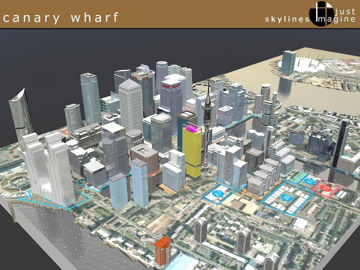
The very latest version of the map is available here - last updated on the 4th of November. I have added 30 tbe South Collonade to it and also Discovery Dock.
 |
||
| |
|
|
|
|
 |
|
 |
||
| To understand
this map please refer to the key to the right which explains what
the colour of each plot is. Some of the designs in proposed / pre-planning
plots are imaginative and for massing purposes only working on the
planned amount of space for the area. To view the quicktime vr viewpoints click on the area in the map and you will get a 360 degree view from that particular location. You will need to have downloaded the quicktime plug-in for this to work properly. Copyright J. Newman 2003. Thanks to Matt Bowker and Jon Smith for their help and encouragement. No reposting or publishing without permission. |
|